perhaps the most impressive part of the story of the High Line Park of New York is that the project started as a result of the activism of neighborhood residents and is a true grass-root movement. There were competing ideas by businessmen and property owners in 80s and 90s to demolish the elevated structure in favor of traditional redevelopment. In 1999, two neighborhood residents and activists Joshua David and Robert Hammond founded the Friends of the High Line and championed the efforts and mobilized the community as well as city administrators and politicians to save the High Line. The result was nothing short of a miracle as (what some would consider) a pie in the sky was successfully turned into a “park in the sky”. To this date, a major part of the park maintenance is supported by the Foundation and volunteers. It has already attracted more than $2 billion dollars of new development to the area around it for residential units, office and commercial spaces. While the notion of “build a cool park, they will come” may sound naïve, the success of High Line park has become as a shining example of how a nice green space can revitalize city neighborhoods. For more details about the High Line including history, timeline, and photos, you can visit its official website at http://www.thehighline.org/.
Wednesday, October 24, 2012
The High Line – time out at New York City
The High
Line at the west side of New York City is an unusual linear park. At this time, it is a free public park at one
mile long with narrow walkway south of 30th street between 10th
and 11th Ave. Unlike typical
linear parks, the High Line is elevated at 30 feet high, cutting through and
standing in between two large avenues of the city.
New York city did not actually spend big bucks to build an elevated
city park from scratch. The structure used
to be a section of the West Side Freight Line built
in mid 19th century by the Hudson River Railroad, connecting southern
Manhattan through midtown all the way north to Albany, the capital of New York
State 150 miles away. In 1934, the
section south of Penn Station at 34th street was relocated west from
street level along 10th Ave to a 30 feet high structure, thus the
name “High Line”, to avoid the frequent traffic accidents and to make loading
and unloading of goods easier. Who would
have thought in only few decades, the hyper growth of the trucking and highway
systems supplanted the rail transportations.
While the north section of the West Side Line beyond Penn Station is
still used by Amtrak, the elevated High Line was abandoned in 1980 and left with
weeds and rust till recent years.
Climbing up staircases at west of the intersection of 10th
Ave and 30th street and turning right, you can see the last section
of the High Line Park under construction that is scheduled to open in 2013. From here, the High Line turns west towards to
the Hudson River and will take visitors through the West Side Rail Yards to 34th
street.
Turning left, one can start the journey south and stroll
down the new section of the park which was opened a little over a year ago in
summer of 2011. As one walks south,
ornamental grasses greet the visitors along with few surviving blooms of cone flowers. Less than few hundred feet, a gigantic mural of
a man, Brandon Many Ribs of a North Dakota Indian tribe, overlooks the High
Line with eyes closed. He appears to be screaming
silently, possibly due to intrusions by the visitors. This is a recent work by the award winning French
street artist JR from his participatory Inside Out Project.
Near 27th street, another mural “The High Line
Zoo” by Jordan Betten and his team is at display on a roof top next to the High
Line. For some unknown reasons, the zoo
animals are all gone from the roof when I compared my photo against that of
the original display found on the net (see photos to the right).
As you walk further south, here comes the most dramatic
illustration of the impact of the High Line on redevelopment. HL23,
an upside down 14 story luxurious condominium with a slim bottom fits snugly right
into the High Line with no space to waste and no more weight o carry (see photo at the left). Ceiling to floor glasses on the north and
south side of the building provide plenty of lights and views for the residents
at the expense of privacy. The building was
designed by Neil Denari and
was completed a year ago with an explicit goal and challenge of maximizing floor
spaces with a tiny base of 40x99 ft and zoning restrictions. There is no question that this building will
become one of the new icons for New York city, just like the IAC building
designed by Frank Gehry in his signature twisted curvy exterior
which can be seen from the High Line near west 18th street.
At the west 18th street, you can also view the huge High
Line Billboard, currently showing Thomas Bayrle’s American Dream –
a classic Chrysler car made of company’s logo.
Near Gansevoort Street, the southern end of the High Line Park, a cute 9-foot
tall figure sculpture Old Singer with
Blossoms by Alessandro Pessoli is hidden in trees and bushes (see photo to the right). For more
about the current art exhibitions, see the web page of the High Line Public Art. By the way, you do need to slow down and pay
attention as you may end up missing some of the works like I did.
perhaps the most impressive part of the story of the High Line Park of New York is that the project started as a result of the activism of neighborhood residents and is a true grass-root movement. There were competing ideas by businessmen and property owners in 80s and 90s to demolish the elevated structure in favor of traditional redevelopment. In 1999, two neighborhood residents and activists Joshua David and Robert Hammond founded the Friends of the High Line and championed the efforts and mobilized the community as well as city administrators and politicians to save the High Line. The result was nothing short of a miracle as (what some would consider) a pie in the sky was successfully turned into a “park in the sky”. To this date, a major part of the park maintenance is supported by the Foundation and volunteers. It has already attracted more than $2 billion dollars of new development to the area around it for residential units, office and commercial spaces. While the notion of “build a cool park, they will come” may sound naïve, the success of High Line park has become as a shining example of how a nice green space can revitalize city neighborhoods. For more details about the High Line including history, timeline, and photos, you can visit its official website at http://www.thehighline.org/.
When High Line was built as an elevated railroad 80 years
ago, it was deliberately made to travel in between 10th and 11th
Ave. As a result, a few high rises had
to make ways allowing freight train to tunnel through the buildings. Some of these
tunnels are now places for street performances and some exhibits. It was such an enjoyment to hear a cellist
play when I was visiting. Other than
taking a sip of water and wiping off his sweats on his face, he was totally
immersed in the music and oblivious to the occasional deposit of changes into his
cello case by visitors.
Walking back north, I
stopped by the Blue Bottle Coffee near
the Upper Chelsea Market Passage at the 15th street. I joined the line, waiting patiently for a cup
of fresh “hand-made” drip coffee. I was
curious if the coffee would taste any better as I watched the barista
painstakingly pouring rounds of hot water into each holder attentively.
The High Line of New York city is not the first elevated linear
park. The idea in fact came from The
Promenade plantée of Paris which is a 2.9 miles long walkway
completed in 1993. The High Line has however
inspired many other cities in U.S. and elsewhere such as Philadelphia, Chicago,
St. Luis and Rotterdam to pursue
conversions of abandoned city railroads into green space with the hope that
they will attract and spur further neighborhood redevelopment.
perhaps the most impressive part of the story of the High Line Park of New York is that the project started as a result of the activism of neighborhood residents and is a true grass-root movement. There were competing ideas by businessmen and property owners in 80s and 90s to demolish the elevated structure in favor of traditional redevelopment. In 1999, two neighborhood residents and activists Joshua David and Robert Hammond founded the Friends of the High Line and championed the efforts and mobilized the community as well as city administrators and politicians to save the High Line. The result was nothing short of a miracle as (what some would consider) a pie in the sky was successfully turned into a “park in the sky”. To this date, a major part of the park maintenance is supported by the Foundation and volunteers. It has already attracted more than $2 billion dollars of new development to the area around it for residential units, office and commercial spaces. While the notion of “build a cool park, they will come” may sound naïve, the success of High Line park has become as a shining example of how a nice green space can revitalize city neighborhoods. For more details about the High Line including history, timeline, and photos, you can visit its official website at http://www.thehighline.org/.
Enjoy your walk and talk to you soon!
Friday, October 5, 2012
North to Alaska
For those who’d like to be
close to and to appreciate wilderness, Alaska is a top destination of choice. It holds more than half of the designated
wilderness area of U.S. and yet accessible by plane, car, and sea. For tourists who have a modest budget and
time but can’t quite stay away from modern facilities and some pampering, one
way to enjoy Alaska is to take a 7 night one-way cruise from Vancouver to
Anchorage for the southeast region of Alaska, aka Alaska Panhandle.
Then one can rent and pick up a car at Anchorage to visit the south
central and central regions of Alaska for places like the Kenai Peninsula and the
Denali National Park. That is what we just
did in late summer.
The name Alaska means “the Great Land” that came from Aleut people who are the indigenous
people of the Aleutian Islands of Alaska.
Situated at the northwest corner of North America and disjoint from the
rest of the U.S., Alaska has an area more than of 600 thousand square miles
which accounts for almost 20% of U.S. and is bigger than most countries of the
world. With a slightly more than 700 thousands
residents, it is also one of the least populated states of U.S. Unlike most states in U.S., Alaska has more
males than females. With its unique
natural resources and climate however, there is a popular joke about Alaska men:
“The odds are good, but the goods are odd.”
Some trivia: What is the north-most
state of U.S.? How about west-most and
east-most? How about the largest state
by area? How about the least densely
populated state? Yes, Alaska is the correct answer for all of the questions
above. (You may quip how could a state
be the west-most and east-most at the same time? Well, technically, parts of Alaska are in eastern
hemisphere and span from longitude 172° to 180° east of the Prime Meridian that
passes through Greenwich, England.) To
give you some idea of the extremes, the population density of New York City is
about 25,000 times more than that of Alaska which stands at 1.26 per square
mile.
Alaska used to be a part of
Russian Empire’s territory. It was sold
to U.S. on 1867 for a mere $7.2 million dollars (equivalent to $120 millions
today) when the Tsar Alexander II made the strategic move using U.S.
to mitigate Great Britain’s threat from its east who controlled British Columbia
at the time.
Did you know that Japan had
invaded and occupied a part of Alaska (then a U.S. territory) during WWII? Yes, Japanese did more to U.S. than attacking the Pearl Harbor. Six months after the Pearl Harbor attack, Japanese
force landed and occupied two of the Alaskan islands - Attu and Kiska of the Aleutian Islands in mid 1942. It wasn’t until almost a year later that American
and allied forces reclaimed those islands with heavy casualties on both
sides.
Historically, Alaska was the first
entry point of humans into the Americas when some groups crossed the Bering land bridge
from Asia during the ice age more than 10,000 years ago. Over time, some moved south, settled throughout
the Americas, and are now referred to as the Indigenous peoples of the Americas whose similarity in features
to Asian offers a clue.
With a vast territory and northern location (the
north most location of Alaska is about 1000 miles from the North Pole), one
usually associates extreme colds with Alaska.
In reality, the climate of Alaska varies a lot depending on the regions. For instance, the southeastern region which
is the popular destination of Alaskan cruises is not much cooler than Seattle
or Western Europe. And Anchorage’s
climate is reasonably mild although due to its latitude, there can be as little
as 5 hours of daylight in the winter. On
the other hand, by some estimates, Alaska does have three million lakes and more
than 100,000 or roughly half of the world’s glaciers.
Typical Alaska cruise itinerary includes visit to Ketchikan, Juneau and Skagway
from south to north on its ports of call.
Juneau is the capital of Alaska but is not accessible from Alaskan
roadway system. The other two towns are
small enough for easy strolls and exploration by foot. While Ketchikan has many wildlife to show
for – from salmon to bald eagles, Skagway is full of colorful human stories and
history, thanks to the Klondike gold rush of 1896. It was the port from where prospectors
prepared for and started their 500-mile journey to the gold fields in Canada. Some never made it to the gold fields and many
never made it back. Very few became
rich. Of course, the real smart ones “mine
the miners” and became wealthy without nearly as much hardship (Now you
understand why people want to work in Wall Street?).
Land excursions at those towns through cruise
companies or independent operators offer opportunities to get close to natural
beauties as well as wild animals such as salmon, bald eagle, grizzly bear, and
humpback whale. More adventurous minded
tourists could also try glacier/ice field trekking, kayaking, rafting, etc. Further north from Skagway, scenic cruising
of Glacier Bay National Park and the College Fjord adds acclamations to the week-long
cruise as majestic glaciers meet the sea water.
For some reasons, our memory of Glacier Bay was different and better
from our first visit a decade ago. The
cruise ship we were on shut the engines and let us enjoy the views and sounds
in complete silence. I can still remember
hearing the sound of crumbling glaciers from miles away with occasional cheers
when one actually sees something.
Otherwise, passengers were mostly whispering as if everyone was afraid
of disturbing the nature. Below are a
few selected photos that I took for your enjoyment. To enlarge, simply left click on the photo.
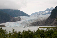
Mendenhall Glacier |
Auke Bay |
Juneau Port from Mt Roberts Tram |
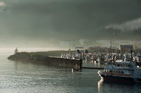
Juneau Cruise Port |
Auke Bay, north of Juneau |
Sea Lions in Auke Bay |
Humpback Whales in Auke Bay |
Margerie Glacier in Glacier Bay |
The disembarkation point of our cruise was Whittier
which is 60 miles southeast of Anchorage. As we stepped out of the cruise ship in early
morning, stunningly beautiful Whittier harbor and nearby mountains veiled in
fog greeted us. Not far from the cruise
terminal, there lies the 2.5 miles long Anton Anderson Memorial Tunnel in one
lane shared by both cars and trains. It
is the second longest highway tunnel of North America (50 ft shorter than the
Ted Williams+I-90 extension in Boston) and is the only land access of Whittier to
the outside world through the Portage Glacier Highway.
The short drive through the Portage Glacier Highway was breathtaking. We in fact returned to the area a few days later for more photo shoots and hikes to see the lake and glaciers. 20 miles west, Portage Glacier road meets the Seward Highway which is a part of Alaska Route 1. If you turn left and heads west-southwest, you can explore the heart of Kenai Peninsula. Turning right and head north, you soon see Turnagain Arm to your left with Anchorage at the far north of the mouth of the Arm at more than 30 miles away. Turnagain Arm is one of the about five dozen places in the world where one can see tidal bore. (but it is not nearly as impressive as the one at Qiantang River of China which has the world's largest bore - up to 30 ft high and moving at up to 25 miles per hour.) During high tides, pods of Beluga whales or white whales (ok, it is a misnomer and is really more like dolphins) follow and chase the silver salmon all the way upstream from Cook Inlet. It is not difficult to spot some of these cute mammals along the highway, one of the only two places in North America where you can watch Beluga whales in the wild.
Turnagain Arm northward |
Alaska Fireweed |
Turnagain Arm when low tide |
Continuing north on Alaska Route 1 past Anchorage, a mere 30 miles out, one reaches Wasilla which is a small suburban town of Anchorage with less than 8,000 residents. It is now internationally known, thanks to Sarah Palin who was its mayor from 1996 till 2002. She was elected as the Governor of Alaska in 2006 and became the Republican Party nominee for Vice President in the 2008 election. To boost her credential on international affairs, Sarah Palin had made the famous statement: "They're our next-door neighbors, and you can actually see Russia from land here in Alaska, from an island in Alaska." Although the statement was technically correct, it was such a stretch from her demonstrated intellects and experiences that the statement became a constant joke of her ignorance of foreign affairs.
Picking up Alaska Route 3, aka the George Parks Highway after
Wasilla and going north along the imposing Alaska
Range at the west, one can enjoy a pleasant drive to Denali National Park
200 miles away. The word
"Denali" came from the native Athabaskan language. It means "the high one", referring to the Mount Denali of the park. It is also known as Mount McKinley, named after
president William McKinley of Ohio in 1897. Mount Denali is the highest mountain of North
America. Peaked at 20,327 ft, it is simply
a gigantic piece of granite that was lifted up into the sky from Denali Fault
as a result of tectonic activities over 10's of millions of years.
Denali National Park and Reserve has more than 4
million acres in area and is the third largest national park of U.S. Because of the low temperature and short
growth seasons, Denali National Park has little wooded areas. Instead, tundra at various
elevations with beautiful fall colors covered much of the ground no matter at which
directions you look. There is only one
Park Road of 91 miles long that takes one from the park entrance to the mining
camp of Kantishna. The first 15 miles is
open to private vehicles. The remaining
76 miles of narrow gravel road is only accessible by Park concessionary buses. A round-trip bus ride with short stops along
the way all the way to Kantishna would be a 12+ hours venture. The reward though is the spectacular sceneries
and possible encounters with wildlife – grizzly bears, mountain sheep, moose,
and more. One new thing I learned from
watching a film at the visitor center was the most impressive camouflage I have ever seen. Look at the photos below and
compare the Willow Ptarmigans (the state bird of Alaska) in late Aug that we
saw and a photo of a Ptarmigan in winter that I downloaded from Internet!
More selected photos follow them below. With a three-night stays, we barely scratch the surface. Next time, we hope we have a better luck with the weather and have more time to hike at various parts of the park.
A lone grizzly bear |
A lone visitor |
Eielson Visitor Center |
Wonder Lake |
Mount McKingley seen from Alaska Route 1 |
Before I go, I should say a few words about food. Material wise, you can’t go wrong with fresh local salmon and halibut. But if you are not sure about the joint, simply order entrees that retain the original flavor as much as possible. We have had decent food at most of the places we visited including the café in the Denali Park. We also had a wonderful outdoor lunch break and leisure walk at Talkeetna on the way to Denali from Anchorage. It is a lovely small town with quite a few cozy restaurants. I had Caribou Chili and a special Ale made with Fireweed honey. With 9% alcohol, that Ale was the strongest beer I have ever had but is very good. The Caribou Chili was nicely done too. It didn't taste gamey as one might fear. Perhaps it has something to do with the fact that restaurants in U.S., as required by law, can only serve game meats that are farm-raised?
Talk to you soon!
Saturday, September 29, 2012
Cheat to Thrive
Recent news reports of large
scale academic cheating at top schools like Stuyvesant High School in New York
City and Harvard University have drawn a lot of attentions. In the recent NY Times article Studies
Find More Students Cheating, With High Achievers No Exception by Richard
Perez-Pena, Professor Donald L. McCabe of the Rutgers University
Business School who is a leading researcher on cheating was quoted to say “There have always been struggling students who
cheat to survive. But more and more,
there are students at the top who cheat to thrive.” He may be right that there have been more
reported incidents or such a trend indicated by surveys. However, sorry to sound cynical, should we be
surprised if there have always been people “at the top”, students or not, who cheat to thrive?
b : to violate rules dishonestly. Wikipedia article on cheating gives it a broad definition: “an immoral
way of achieving a goal. It is generally used for the breaking of rules to gain
advantage in a competitive situation. Cheating is the getting of reward for
ability by dishonest means.”
There are several critical
words in these definitions that warrant closer
examinations.
What is considered immoral?
Is it a function of particular community and time? Who define the rules and how are rules upheld and enforced? Are the criteria of cheating
absolute or relative? What if there is
no reward involved? What if the underlying
situation is not competitive? Is the
same behavior now still
considered cheating?
For the recent Harvard
scandal (see NY Times article Harvard
Says 125 Students May Have Cheated on Exam), the
professor did tell the students that they must work alone in the take-home
open-book, open-internet final exam.
When the professor saw the similarity of the answers in many of the
papers submitted, he did the right thing and reported the incident to the
administration who opened the investigation.
For the Stuyvesant High School scandal (see NY Times article Allegations
of Widespread Cheating), the scandal became public when the Principal
confiscated a student’s cell phone during a city language exam and uncovered
evidences of widespread cheating.
Are these students “cheat to survive” – to survive
in a highly competitive environment?
Note even at Stuyvesant and Harvard, by definition, half of the students
are below median in their class! Since the
cheats appeared to be “business as usual” to many of the students involved
according to the reports, I would guess at least many of the offending students
belong to the group of “cheat to thrive”.
Thus a more sombering question is what is happening
with our society as a whole? Is there a
trend of increasing moral delinquency especially among the elites? Is
this just a tip of the iceberg? After all, these are not isolated incidents
and students have not been the only ones caught cheating. Only a little more than a year ago, 178
Atlanta public school teachers and principals were accused of altering students’
grades in high-stake standardized tests.
As many have observed, technology and tool advances
have made cheating easier. Obvious example
is cell phones with camera and texting. Copy
and paste features in word processing software allows people to lift others’
writings effortlessly. Further, there
are abundant resources online at our finger tips. With powerful search engines, one can plagiarize
any subject matter even at advanced levels.
All in all, the popularity and ease of sharing over Internet have eroded
the time-honored respect for originality, authorship and ownership. I have seen highly educated and accomplished
adults lifting regularly others’ work in their communications without
attributions. While one may argue that there
are no explicit or direct rewards in some of these cases, one cannot stop
wondering what kind of role models and what effects would it have on next generations?
Misguided promotion of group
work in school is also a suspect. Group
work sometimes does degenerate into straightforward copying and sharing of
final outputs and credit without division of work and responsibility. To some, the lesson learned from team work is
how to get more easy awards by taking others’ credits instead of the true
meaning of collaboration that one plus one can be bigger than 2 and that it is
the only way to work a complex problems effectively.
Competition
for reward and satisfaction is certainly a huge factor in inducing cheating
behaviors, especially for the elites. A
famous example can be found in the NOVA program Secret of Photo 51 that details the history of Rosalind
Franklin's contributions in the discovery of the double helix
structure of DNA. The 1962 Nobel Prize
in Physiology or Medicine was given to James Watson, Francis Crick and
Maurice Wilkins who, along with their Lab directors, knowingly neglected to mention
that their successful discovery and breakthrough model was critically dependent
on Franklin’s experimental results to which they had obtained access without
her permission. I am sure you have no problem finding plenty examples
in politics and business world where people constantly dance between the fine legal
and ethical lines. In his Sept 24th New York magazine article Cheating Upwards,
Robert Kolder had an in-depth profile about Nayeem Ahsan, the Stuyvesant High
junior who was in the center of the recent cheating scandal. Do you know what
was his dream college? Yes, it was Harvard.
Do you know what his dream career is? It is investment banker. Should we be surprised that there is less and
less trust the public have on our political and business leaders?
Why do people cheat? I can think of
many reasons and you can too: no one is watching, others do it (and I would be
disadvantaged if I don’t), the reward is worth the risk of getting caught and
the possible penalty if caught, the thrills and pleasure, help a friend in
need, it won’t really hurt others, and because I can, just to name a few. Sadly, cheating appears to be universal throughout
human history in all civilizations. Let
us be honest. A vast majority of us do have the temptation to cheat from time to time (Perhaps, it comes from our survival and competitive instinct?). Given that, and given that a
dominating factor in cheating is how easy it is and how high the penalty is, the
solution seems clear. More transparent
process, more safeguards, raise penalty and enforce the rules. Success should be commended but cheat to
thrive must not be tolerated.
Talk to you soon!
Saturday, September 22, 2012
Kinmen Highlights
In my last blog, I talked
about our recent visit to Tainan 台南where
modern history of Taiwan began when the Dutch set up its trading post there almost
400 years ago. Dutch’s 38 years of occupation ended in 1662 when Zheng ChengGong 鄭成功 (aka Koxinga 國姓爺 and Prince of YanPing延平郡王) and his men laid a 9 month siege of Fort Zeelandia
(aka AnPing Fort
安平古堡) and drove the Dutch out of Taiwan.
Who was Zheng ChengGong? Where did he and his men come from? To get some appreciation to the answers to these questions, one can backtrack the footsteps of Zheng ChengGong 鄭成功and pay a visit to Kinmen金門, a group of islands110 miles west of Taiwan and a little over 1 mile off Xiamen 廈門of Fujian Province of China. Zheng and his navy force were based there between 1651 and 1661 prior to sailing to Tainan and forced Dutch out.
Zheng ChengGong鄭成功 was born to Zheng Zhilong 鄭芝龍 and his Japanese wife Tagawa
Matsu at Hirado, southern Japan in 1624, the
year Dutch started building Fort Zeelandia in Tainan, Taiwan. At age 7, he and his mother were brought back
to Nan'an 南安, Quanzhou 泉州 (north of Xiamen) and reunited with his father.
Zheng Zhilong is an important character in history. For one, Zheng ChengGong’s career was made possible with his
father resources and organization. Zheng
Zhilong appeared to be a smart and ambitious young
man, judging from the stories of how he left home as a teen. He earned his livings first on merchant ships
and eventually made his way to Japan where he met his mentor Li Dan, a rich
Chinese merchant. At age 19, he took
over the fleet of his mentor when Li passed away. By age 23, he was already the most powerful
pirate/merchant in the region with 400 junks and tens of thousands of men.
In those days, with a weak Ming government in China
and competing colonial forces and traders, one can imagine the lawlessness on
the high sea from East Asia all the way south throughout Southeast Asia. Zheng Zhilong and his men appeared to be
engaged in activities from trading to looting and offering protection to others
for fees. He in fact organized and
headed a major pirate organization called Shibazhi 十八芝, not unlike the Godfather of a mafia. At age
24, after defeating Ming navy, Zheng Zhilong decided to go legit, accepted an
official appointment and worked for Ming while continuing to operate his now a
formidable 800+ ships fleet and organization.
Zheng Zhilong was probably serious about going
legit (remember the all time classic 1972 movie The Godfather?). He had his son Zheng ChengGong brought up
with the traditional Confucian studies who in fact had passed the first level
of imperial
examination科舉. When
Beijing fell to Qing’s hands in 1644, Zheng ChengGong was in fact a serious
student at the Nanking University.
Zheng Zhilong was initially supporting Ming Dynasty
in resisting Qing’s conquer of China. He
helped enthroned Longwu Emperor of the Southern
Ming in Fuzhou, Fujian under his protection. However, he switched side and defected to
Qing a little later. Perhaps as a hedge
of his bet, he left his men and resources with his son Zheng ChengGong who
continued to be loyal to Ming and resisted Qing. What he probably had not expected was his son’s
royalty to Ming Dynasty never wavered that caused him his life as he was
executed by Qing in 1661.
In 1651, Zheng ChengGong moved his fleet and men to
Kinmen and continued to look for opportunities to restore Ming and reclaim the
mainland. Ten years later in 1661, he
took his men and fleet to Tainan, drove out the Dutch and set up Taiwan as his
new base. For those who are familiar
with the history of modern China, the parallels are striking and eerie with Chiang
Kai-Shek’s move to Taiwan with his Nationalist government almost 300 years
later. Zheng ChengGong died young however at age 37
in 1662 due to malaria. He never set
his foot on the mainland again after he left Kinmen. Neither did Chiang Kai-Shek after he
retreated to Taiwan in 1949.
Zheng ChengGong is
a rare example in history where an individual is still revered as a hero long after his
death by all interested political entities – Communist China,
Nationalist China, Taiwan Independence Movement, and Japan. Every one of these entities was
able to find something in him that they can use to promote their agenda: Japan likes to play up its
connection with Taiwan using the fact that
Zheng’s mother is a Japanese. Communist China likes to emphasize the nationalism using the fact that he drove out the Dutch colonial power and kept Taiwan in Chinese’s hands. Nationalist China likes to talk about his dedication to and goal of reclaiming mainland with his unwavering loyalty to Ming
Dynasty. Last, but
not the least, pro-Taiwan-independence movement likes to emphasize Zheng’s
founding of Tungning Kingdom, resisting mainland China’s takeover of Taiwan.
Now back to Kinmen.
For visitors, the natural place
to start is the Grand Kinmen (or Greater Kinmen)大金門, the main
and largest island of Kinmen islands which is less than 1 hour away by plane
from Taipei. Grand Kinmen is a dumb bell
or H-shaped island of over 50 square miles, more than twice the size of New
York Manhattan! After Nationalist
government retreated to Taiwan in 1949, Chiang Kai-Shek had placed as many as 100
thousand troops in Kinmen islands. Along
with the Matsu Islands 馬祖, it served for four decades as the first
line of defense for Taiwan and as a launching pad for military actions against
Communist China.
To appreciate how close Grand Kinmen is to
Communist China controlled territories, one needs to visit the MaShan Observation
Post 馬山觀測站at the northeast
corner of Grand Kinmen. Looking out from the Observation
Station in a heavily fortified bunker, one sees clearly
the island of Jiao
Yu island 角嶼of mainland China at 1 mile away in low tide.
It is totally believable that Dr. Justin Yifu Lin 林毅夫 , a top Chinese
economist and former Senior Vice President of World Bank, did swim across on
his own in 1979 and defected to Communist China when he served as the Company
Commander at MaShan Observation Post. Indeed,
the distance between Kinmen and the mainland China is so small that for
decades, nationalist and communist China had engaged in psychological warfare
with loudspeaker walls (a group of 48 huge loudspeakers) and gigantic
loudspeakers. Each would blast announcements, speeches, and performances to the other side directly over the sea, 24 by 7. The Taiwan TV news report below gives you an
idea how the facilities looked like and how it worked.
At 253 meters, TaiWu Mountain 太武山 is the tallest
and only mountain in Kinmen. Zheng
ChengGong used to come to the mountain top with his staffs to observe the
training of his navel force. Following
the roadway, one can take a leisure hike from the parking lot at the base to
the top to visit the observation point of Zheng’s to have a panoramic view of
the islands and sea (see photo to the right).
A little further up, one will see the landmark 100 ft tall granite rock
with Chiang Kai-Shek’s writing 勿忘在莒 as well as the 800 years old HaiYin Temple 海印寺.
Kinmen became known to the world during the Second Taiwan Strait Crises, aka the Quemoy Incident or the 823 Artillery Bombardment 八二三炮戰. The intensive and nonstop shelling of the island
was begun by the Communist China on August 23rd 1958 that lasted for 45 days till Oct 6. Almost half a million shells were fired that translates
to approximately 15 shells per acre in average, and 2500 Nationalist troops
were killed. After the failed attempt
to force the surrender of Kinmen, the bombardment evolved to a peculiar protocol
where two sides would fire at each other (Matsu islands included) on alternate
evenings with propaganda shells filled with pamphlets. The practice continued till the normalization
of U.S. China relationship in 1979. What
was unexpected was that the shells collected on the Kinmen islands had become a
popular material for handmade cleavers, now a souvenir and gift item for
tourists.
The less well-known but a more significant battle involving Kinmen between Communist and Nationalist China took place
eight years earlier. It was the Battle of Kuningtou古寧頭之役and lasted only three days in Oct,
1949. Communist
China’s plan was to dispatch 19,000 troops and launch an assault of Kinmen
against 40,000 Nationalist garrisoned troops.
If successful, there was little doubt that Taiwan will be the next
target and Chiang’s Nationalist government will fall. However without a naval force and adequate training,
only 9,000+ PLA troops were able to land on Kinmen after making several major tactical
errors. The assault ended up to be a
disaster - almost 4,000 of PLA troops were killed and the remainders captured. The battle marked the last hand-to-hand
combat between Communist and Nationalist China.
Six months
later, Korean War broke out in June 1950.
U.S. government expanded its containment policy to Asia against
communism and signed the US-ROC Mutual Defense Treaty with the Nationalist government. Note the Treaty excluded Kinmen and Matsu
islands. Indeed U.S. did not intervene during
the 823 Artillery Bombardment 八二三炮戰 in 1958, other
than providing some critical weapons and supplies.
Now it is all peaceful and quiet in Kuningtou which
is at the northwestern corner of the Grand Kinmen. A small gate greets the visitors to the park
and museums. The blood of soldiers on
the beach had long dried out and washed away, only a lone fisherman was there (see photo to the right). We stayed at a traditional guesthouse 古厝民宿for two nights at the local Lin village林厝聚落. Combined with modern in-room
facility, this restored 250+ years old house retained the magnificent Southern
Min 閩南architecture and layout with added comfort
and convenience (see photos below). An evening after-dinner
tea at the courtyard and the front yard is a perfect way to end the day. Light breeze over the lotus pond wipes away
the heat of the day and rejuvenizes one’s body.
Of course, there are a number of well-maintained
old traditional houses on the islands. The popular and most photographed is a cluster
of 18 houses, family shrine included. It
belongs to a Wang Family and is located at ShanHou village山后民俗文化村 (see photos below). One can also find other interesting
architectures on the island as well. In
particular, the island has several large two story western style houses that
are often seen in Southeast Asia. They
were invariably built by those merchants who immigrated from Kinmen to Southeast
Asia. Sending home the needed fund and
blueprint of the house for it to be constructed was a clear declaration and
celebration of their successes.
For skyscrapers, one needs to look westward across
the sea however. There stood Xiamen, one
of the largest and most populated cities on the southeast coast of mainland
China. Standing at CiTi 慈堤 facing
west, one can see the skyline of Xiamen behind the antique tanks used during
the battles 60 years ago (photo to the right). On the beach,
defending the amphibian assault are arrays of poles made of rail woods that
pointing at an degree towards to the sea and sky. They still serve a vivid reminder of the war
however primitive they may look. The military
conflict had been replaced with trades and tourism but political tensions of two vastly different systems continued. Now Kinmen residents can take
a convenient 20 minute ferry ride and spend weekends in Xiamen to enjoy city
life with entertainments and shopping. Not surprisingly, despite
the deep cultural and economic ties with China, Kinmen residents
reject overwhelmingly both Taiwan-independence and communist rule.
Kinmen had suffered much as the frontline during
decades of military conflicts between Nationalist and Communist China. A new direction for economic development began
to take shape when martial law and military rule of Kinmen ended twenty years
ago in 1992. In 1995, a significant
portion of Kinmen islands was designated as a part of the new Kinmen
National Park that helped provide the focus and resources needed to
transform Kinmen. Thanks partially to
the revenue generated by the highly profitable Kinmen Distiller for its Sorghum
Liquor 金門高粱酒, Kinmen is now ranked the happiest place to live in Taiwan according to
a recent survey by the Taiwan
Competitiveness Forum. When you visit Kinmen, don’t forget to
bring home and me some Kinmen specialties like its hand-made ultra-thin pasta麵線, Peanut
GongTang 花生貢糖, and Sorghum
liquor. Cheers to Kinmen and its people!
Talk to you soon!
Subscribe to:
Posts (Atom)