Showing posts with label culture. Show all posts

Wednesday, January 22, 2014

Puerto Rico – the Spanish U.S.


¡Hola!  In addition to the familiar 50 states and the (Federal) District of Columbia, U.S. has a number of territories.  These are land masses that the country has acquired over the centuries in Caribbean and Pacific Ocean.  With a size of over 9,000 square kilometers (1/4 of the size of Taiwan) and 3.7 million population, Puerto Rico at the (means “Rich Port”) tropical Caribbean, east of Haiti/Dominican Republic, is technically an organized (i.e. self-ruled) but unincorporated (i.e. U.S. Constitution does not fully apply) territory.  It is also the largest and most populated of all territories.  Although both English and Spanish as its official languages, Spanish remains the dominant language.  Incidentally Luis Muñoz Marín International Airport at the Metropolitan San Juan, Puerto Rico, is the busiest passenger hub for the entire Caribbean.

Going back 520 years to November 19th of 1493, Christopher Columbus reached Puerto Rico and claimed it for Spain in his second voyage to Americas with the purpose of establishing settlements and permanent colonies.  What happened in the ensuing centuries to the indigenous Taíno people of the region was the familiar sad stories of the colonial world – forced tributes, forced labor, slavery, oppression, epidemic diseases, completed with cultural genocide inclusive of religious practice and belief.

During the subsequent 400+ years of occupation and rule of Puerto Rico, Spanish Empire had successfully suppressed the initial Taino insurrections, fended off the attacks by other colonial powers such as French, British, and Dutch.  However, after decades of decline of the Spanish Empire in 19th century, the final blow was delivered by U.S. with the 10 week long Spanish-American War of 1898 when U.S. intervened in the Cuban Independence under the name of protecting its citizens and business interests in Cuba.  Spain was defeated in both theaters - Philippine and Guam in Pacific, and Cuba and Puerto Rico in Caribbean.  The result was the Treaty of Paris by which Spain ceded all its colonies to U.S. outside Africa including Puerto Rico and Philippine.  For U.S., the victory changed the American public sentiment and boosted significantly the American imperialism and international involvement.  It also sent the war hero Theodore Roosevelt into White House a few years later as the popular 26th president of U.S.

Unlike Cuba of which U.S. promised the support for the independence from the very beginning of the war, Puerto Rico’s political status has remained unclear with the population divided in preferences ranging from independence to statehood.  While ballots are now the places to express choices, tension between U.S. Federal government and pro-independence movement had sometimes reached boiling point during the last half of the 20th century.   Extreme groups such as Fuerzas Armadas de Liberación Nacional (FALN) had resorted to “armed struggles” and violent “terror attacks”.  However the latest Puerto Rico status referendum in 2012 reports about 54% of voters do not want to continue with status quo and among voters who answered the multiple choice question of statehood, independence or a sovereign nation in free association with the United States, 61% chose statehood and 5.5% chose independence.

A good place to start with in retracing the old Spanish colonial history in U.S. is the Old San Juan, the oldest Spanish settlement in Puerto Rico.  Connected to the main island via three bridges, Old San Juan is a narrow and tiny island near north shore of Puerto Rico.  At a mere ½ mile long and 2.5 mile wide with plenty of facilities from lodging, restaurants to stores and galleries concentrated in western half of this small island, it is a perfect place for tours on foot.  


Much of the old San Juan is still surrounded by centuries old 40+feet tall thick stone walls.  Thanks to the efforts by a few local activists, scholars and political leaders in late 1940s, the neighborhood escaped the bulldozer and modern redevelopment elsewhere and was revived while retaining its original Spanish architecture (photos above).   Today, one can stroll down the narrow cobble stone streets at ease, admire the bright and colorful two story houses with windows and balconies often decorated with flowers.  When tired, one can rest at the benches of public squares, sit with the late salsa composer Tite Curet Alonso (center photo above), have a cup of coffee/espresso with Mallorca.  When hungry, go into one of many eateries and have some pernil (roasted pork shoulder) and mofongo.


Located at the mouth of the San Juan Bay and as a gateway to the main island, Old San Juan’s military importance 500 years ago was obvious.  Fort San Cristóbal at the northeastern shore of Old San Juan was the largest fort Spanish ever built in Americas to protect the city from land attack.  Today, only 1/3 of the fort remains but still impressive.  On the top level of the fort, one can see the skyline of the (new) San Juan in its east.  See photos to the left.
Less than a mile west of Fort San Cristobal, there lies an even more impressive Fort San Felipe del Morro at the tip of the northwest corner of Old San Juan.  It is now a part of the National Park system and one of the UN World Heritage Sites.   Designed, constructed and continuously enhanced and updated since 16th century, El Morro is a 6-story structure with 18 ft thick walls and interconnecting tunnels, rising from the sea at 145 ft tall.  It performed its duty quite well to defend the threat from the sea and protect the port of San Juan.    Right next to it on the shore is the Santa María Magdalena de Pazzis Cemetery where many famous Puerto Ricans were buried, see photo at right.

As a popular tourist destination, Puerto Rico has plenty of natural beauties to offer from tropical rain forests to pristine beaches.  A less known but magical place to visit is Vieques, a small island east of the main island accessible by ferry or frequent 8-seater propeller planes.  Measured at 4 mile long and 21 mile wide (comparable in size to the Kinmen island, see my blog Kinmen Highlights), Vieques has a sparse population of fewer than 10,000 with increasing number of tourists as its popularity grows.

During the first three hundred years of Spanish rule, Vieques was not getting much attention by the Spaniards and was frequented by pirates and outlaws.  It wasn’t till the 19th century when Spanish began to make more earnest efforts to establish order on the island and to set up large sugar cane plantations.  However the growing economic development took a nose dive when sugar market tanked in 1920s and the Great Depression commenced.  Vieques’ course took another dramatic churns when World War II broke out and U.S. Navy acquired and expropriated 2/3 of the land of the island.

One of the most visible reminders of the Vieques modern history is El Rompeolas (The Mosquito Pier), a one mile long pier to nowhere at the northwestern shore of the island; see photo to the right.  You can’t miss it from the air when you fly in and out of the tiny airport on the north shore of the island.   In 1941, when U.S. saw the development of World War II at Europe became worrisome with the distinct possibility that Great Brittan might fall and the war could spread to the Americas, it decided to build a giant navy facility in Caribbean for the U.S. Atlantic fleet and the surviving British fleet.   Initial constructions include a sea wall that would connect Vieques and the main island of Puerto Rico 8 miles west. 

It turns out the real threat came from Pacific rather than from the Atlantic when Japanese made the surprise attack of Pearl Harbor 6,000 miles away on December 7th, 1941.  The navy base and sea wall construction was stopped and later abandoned.  Vieques island itself however has become a convenient place for military exercises and used as a bombing target by U.S. Navy ever since.  After many decades’ numerous but fruitless protests by the locals, the 1999 incident of the death of a civilian in a Navy bombing exercise finally drew the national and international attention.  Many celebrities and activists in U.S. and world joined the protests and civil disobedience.  Eventually U.S. Navy relented and withdrew from the Vieques and turned its land to the U.S. Fish and Wildlife Service in May 2003.  Till this day, parts of the eastern and western ends of the island remain restricted because of the danger posed by unexploded bombs.   Some local residents are still angry and bitter about their or their parents’ forced relocation that occurred more than 70 years ago. 


Today the tranquil farms, ranches and former fishing villages on the island no longer hear the bombs and missiles fly over their heads and explode nearby.  Instead they are increasingly invaded by tourists and entrepreneurs.  Beautiful white-sand beaches with azure water are not crowded and easy to reach by (rental) car, bike, taxi, "carros publicos" (shared van bus) or for some, simply walking.
When you are tired of tanning and water, try horseback riding.  Like most of stables in U.S. that cater to tourists, you can do a horseback riding without any prior lessons or experience in Vieques as well.  It is a wonderful outing at sunrise or sunset to ride horses on the beach, through the trails into valleys and over the hills with panoramic views of the island and ocean.  

Viequest horses are quite special.  They are Paso Fino (meaning the horse with fine gait), descendents of Spanish horses the conquistadors brought at the beginning of 16th century.   These horse are born with the ability to make evenly spaced four-beat lateral moves at varying speed called paso gaits.  It is so pleasing to hear and see a horse walking down the street in this fast distinct paso gaits – hooves moving close to the ground in order of right rear, right fore, left rear, left fore.   For a video demonstration and explanation of gaits of Paso Fino, you can click on the following Youtube video http://www.youtube.com/watch?v=yP2dTIAikTc  By the way, horse gaits simply describe the ways horse moves that include the well-known (in an increasing speed) – walk (4-beat), trot (2-beat), canter (3-beat), and gallop (4-beat).   I suppose in a similar way, some of us are born with the ability to perform certain rhythmic dances and some can’t!

To top your list off, you must take an evening kayaking tour during new moons of the rarely seen natural phenomenon - bioluminescence.  There are many living organisms found from land to sea that emit light.  Fireflies are perhaps the most familiar and popular insect that can be seen flashing light at night.  Marine bioluminescence is more mysterious due to the limited accessibility but there are plenty of organisms in water from bacteria and protists to fish and squid that are luminous.  (Sorry, there are no luminous mammals, flowering plants, birds, reptile, or amphibians.)

If you have never experience the phenomenon before, you may have seen the computer animated whale scene (http://www.youtube.com/watch?v=2vGhezgI5Es) in the 2013 Oscar winning film Life of Pi which is a dramatized and exaggerated version of it.   Indeed, according to the winning cinematographer Claudio Miranda of the film, the inspiration and idea occurred to him and Director Ang Lee when they saw bioluminescence in a bay in central Taiwan. 

In nature, one major actor is a single-celled micro-organism (a type of algae) called dinoflagellate. Unlike adult fireflies who use flash patterns of bioluminescence to communicate with each other for courtship, dinoflagellates flash blue or green lights as a defense mechanism when its cell are pressed.  For a scientific explanation of how dinoflagllates generate light, you can start with the following UCSB link http://scienceline.ucsb.edu/getkey.php?key=3231.  It suffices to say that dinoflagellates garner their energy from photosynthesis and other food/nutrients during the day that allows them to produce sparks when the water they live in are agitated.


The Bio Bay of Vieques is one of few places one can see easily such an amazing phenomenon in significant scale.  As you paddle and move your kayak, a blue trail is left behind in otherwise a total darkness.  While not doing the justice, the photos sourced from the net do give you some idea of what is like.  What is more amazing is when you see a fast moving fish or a school of fish pass by.  You see long flashes move around rapidly in the water.  When you scoop up some water, your hands light up like a small X’mas tree with blue sparks for a short brief moment.   There is no words to describe those moments other than being purely magical.


Puerto Rico, I will be back.  Adios, voy a hablar con usted pronto!

Saturday, March 2, 2013

On Perspective


In my last blog, I touched upon Picasso’s choice of not pursuing further and total abstraction back in 1911.  Instead, he took a different path and retained some figural representation in his works that shaped cubism and influenced development of modern arts.  Still, many of these paintings are not easy to comprehend.

One reason and an important technique found in cubism and modern arts is the use of multiple perspectives. That is, a painting can be composed of multiple views of one or more objects on the same canvas.  As a result, an object could be broken up with each fragment being represented in different perspectives and placed once or multiple times on the canvas.

Equipped with the ability to recognize figurative representation of familiar objects, be it ultra realistic, or partially abstract, we can still identify some of these scattered fragments without too much difficulty.  However, at first sight, the resulting paintings look odd since they defy our visual experience of the straightforward single perspective or snapshot view.  There are many such examples including Picasso’s 1918 Harlequin, his later Surrealism works including the 1937 Weeping Woman and the 1952 Girl in Chair (see photos below, from left o right). 


Note each part of the human figure subject appeared only once in these paintings, regardless how out-of-place it may be.  It is then not a huge leap to having multiple views of the same part of a figure that appear on the same canvas simultaneously as shown in his work 1938 Head (see photo to the right)

Similarly, Marcel Duchamp’s 1912 work Nude Descending a Staircase, No. 2 (see photo to the right) is also not difficult to decode.  It brought even more directly the fourth-dimension, namely, time into painting using multiple perspectives (over time, in this case).  The canvas can obviously be thought of as an overlay of successive frames of a motion picture from a fixed vintage point in which the subject walks down a staircase.  

A little digression is in order.  One obvious motivation for drawing and painting in human history has been to record and to represent what one has seen through their eyes.  To that end, the first value judgment of such a record would naturally be the accuracy of it, or how “realistic” is the painting compared to our experience.  No wonder Leonardo Da Vinci had famously said “The most praiseworthy form of painting is the one that most resembles what it imitates.”  That is exactly what the artists in Renaissance were striving for 600 years ago – they wanted to make the painted scenes look as natural and real to the viewers as possible. 

Renaissance artists’ solution to this challenge was Linear Perspective.  It was developed in Florence, Italy in early 1400’s whereby artists paint the objects as they appear on an “imaginary window” in between the viewer and the field of objects.  More precisely, if one draws a straight line between a point of the actual object and his/her eyes, the intersection of this line and the imaginary window should be the location of the corresponding representative point of the object on the canvas.  Below is a popular example - the painting Ideal City by Piero della Francesca.


A consequence of this viewer-centric projection method is that objects further away from the viewer would appear smaller and parallel tracks appear to converge into a point at infinity, the so called vanishing point.  However as the viewing angle becomes wider and exceeds more than say 60 degrees such as in some landscape paintings, it becomes difficult to represent accurately what our eyes see in a two dimensional flat surface.  Camera fisheye lenses are photographer’s solution to this problem with a nonlinear projection that carries a significant distortion.

Technically and strictly speaking, there is no single or completely accurate representation that works universally.  For one, we are talking about placing faithfully the details and relationships of all objects in a three- or four-dimensional space (or space-time) onto a finite 2-dimensional canvas.  Further, viewer’s eyes are known to wonder around the picture, consciously or unconsciously, and their brains do produce varying responses depending on the order of and how the stimuli are presented.  Artists can express and communicate more effectively if they can influence how viewers view and respond to their works.  That is why perspective matters.

The implication of the viewer-centric perspectives such as the linear perspective is that the viewer naturally responds to and interacts with the painting from outside the painting.  An alternate choice of the representation is the parallel system by which projection rays are parallel to each other.  Such a system in fact has been used earlier in Western and in many cultures/civilizations.  In fact it was used extensively in Chinese paintings for thousands of years.  Below are two examples from a recent paper by Christopher W. Tyler and Chien-Chung Chen. The photo on the left is Gu Hong-zhong’s 顧閎中classic painting Han Xi-zai Gives a Banquet (韓熙載夜宴圖) during Five Dynasties 五代 (907~ 950 AD).  On the right is a wall painting of a Roman bakery from the 1st century found in Pompei.  For more detailed discussions, one can refer to the paper Chinese perspective as a rational system: Relationship to Panofsky’s symbolic form which was published on Chinese Journal of Psychology, Volume 53, Issue 4, Pages 371-470, December 2011. 

The significance of what parallel system offers, in contrast to that of linear (or non-linear, for the matter) perspective, is the object-centricity and viewer-independence.  One no longer relates to the painting through an invisible viewing window external to it.  Instead, one can be inside the painting and does not have a fixed physical view.  The beauty is that once removed from the viewer-centricity constraint, artists can express freely their own feelings, experiences, and imaginations, be it real or unreal.  They don’t have to maintain consistent views of all objects simultaneously from a fixed external viewer’s point of view!  One result of it is the scene may appear odd and obscure, and may not conform to our daily experiences.  But who is to say one must be realistic and adhere to the linear perspective of the Renaissance’s?  On the right, you can see the photo of one of the most revered classical Chinese landscape paintings.  It is entitled Travellers among Mountains and Streams (谿山行旅) and was painted with ink and slight color on a 6¾ ft x 2½ ft silk scroll by Fan Kuan 范寬  It is not realistic by the measure of  linear perspective but nevertheless a beautiful painting! 

I would submit to you that for this reason, parallel and mixed representational system with multiple perspectives are often found in Cubism and other 20th century modern arts.  The brilliant contemporary British artist David Hockney has made in-depth expositions on the topics of perspective.   In his 2012 interview with Martin Gayford first published on The Daily Telegraph, Hockney was quoted to have said:  “Cubism was an attack on the perspective that had been known and used for 500 years. It was the first big, big change. It confused people: they said, ‘Things don’t look like that!’ Actually cubism was concerned to claim: yes they do in a way.”  He then went on and added that “In Picasso’s pictures you can see the front and back of a person simultaneously. That means you’ve walked round them. It’s a sort of memory picture; we make pictures like that in our heads.”  

David Hockey’s photo collages and composite Polaroid pictures as he first re-examined Cubism back in 1980s are excellent examples of the importance and endless possibilities of distinct perspective.  Below are two of these collages on http://www.hockneypictures.com are included here for your convenience.  The one on the left is his 1983 work Walking in the Zen Garden, Ryoanji Temple in Kyoto.  The one on the right is his 1982 composite Polaroid photos Don & Christopher. 


With it, you would not be surprised then to hear that Hockey has been quite intrigued by the classical Chinese scroll paintings as they addressed some of the very issue of perspective in its own unique approach.   In scroll painting, in addition to using stationary single or multiple perspectives, the representation of four-dimension time-space relations on a two dimension space is accomplished by continuously shifting the perspective with changing vintage point from right to left.  As one views only a small and a few feet wide portion of a seemingly endless scroll at a time, the viewer is no longer bounded by a fixed and bounded window – one of the very constraints that Dave Hockney was trying to remove in conventional western painting and photography.

Below is a brief segment of the 47 minutes long 1988 documentary film entitled " A Day on the Grand Canal with the Emperor of China" by David Hockney and Philip Haas that discusses aspects of Perspective in Chinese Scroll Painting.  The subject is the late 17th century scroll painting The Kangxi Emperor’s Southern Inspection Tour 康熙南巡图by Wang Hui王翚 and his team.   It is a series of twelve massive hand scrolls, each one measuring from forty to eighty feet in length!  The techniques of multiple simultaneous perspectives and parallel system combined with shifting perspective can clearly be seen throughout.  The first 10 minutes of the documentary is available on Youtube.  (https://www.youtube.com/watch?v=nmMasnL5VZg).  Enjoy them by just wondering around in the scenes and don't worry about the realism and don't try to view it from your imaginary external window!


Hope you find the subject of perspective fascinating which is found in many fields beyond arts including computer graphics.  It definitely helped me understand better the history and techniques in both Western and Chinese Arts.  Talk to you soon!


Sunday, February 24, 2013

Inventing Abstraction


When meeting an abstract painting, my first reaction is usually “What are you saying?!”   When I attempted an abstract painting for the first time, it dawned on me that I did not even know where to begin; it is so much easier to paint something real.  Why is it so hard to appreciate abstract art?

My Aha moment came when we went to the exhibition Inventing Abstraction, 1910–1925 at the MoMA (Museum of Modern Art) in New York on Feb 17th on the 100th anniversary of the legendary 1913 Armory Show in New York City when modern European art was first introduced to the public in United States.

As one walks into the gallery of this special exhibit on MoMA’s top floor, you are greeted by a 1910 painting of the master artist Pablo Picasso (see photo below on the left, sourced from Google Image).  If you try to search for a clue to figure out the subject of this painting, you may barely identify an object at the lower center of the painting that looks like a mandolin.  The rest of the painting however looks more like mumble jumbles no matter how pleasing and appealing to our visual senses.   If I tell you the title of this painting is “Woman with a Mandolin”, you may possibly convince yourself and others, after the fact, that the forms and lines above and behind the mandolin could be a woman figure (could it be a man?).   If I show you a pre-cursor entitled “Girl with a Mandolin” that Picasso had done earlier in that Spring of 1910 (see photo below on the right), does everything make more sense to you now? 


It became clear to me then that the main reason I could not decode completely this important work (and most other abstract paintings) because there is almost nothing in the painting looks familiar to me (based on MY knowledge and experience.)    That is, if the artist and I do not share similar experience and can’t communicate in some common languages, and if there is no supplemental information or “translation”, how could I possibly hope to understand what the artist is saying through his/her work?  Indeed how is this any different from other situations when we are confronted with something foreign and outside of our expertise or experience?  With such a realization, I no longer feel intimidated.  I realized that I can in fact do better.  I can learn a little more the context and the language of the artists to communicate with them through their work.

The painting “Woman with a Mandolin” was fittingly placed at the entrance of this exhibition because it was a bifurcation point in Western modern art.  It represents the furthest Picasso had gone in his works in terms of the level of abstraction. While many artists had continued to pursue abstraction in various ways at the time, Picasso chose instead to add back more (fragments) of figurative representations (or what he called “attributes”) to his subsequent works including those that defined Cubism, the most influential art movement of 20th century.  One of his famous quotes was that “There is no abstract art. You must always start with something.”  Many art historians had noted that Picasso believed strongly in maintaining the connection between his work and the things in real world.  

Turning to the right after viewing Picasso’s “Woman with a Mandolin”, one sees another historical painting - Wassily Kandinsky’s 1911 “Impression III (Concert)” (see photo on the right, sourced from Google Image).  Again, if you did not know the title nor the context of the work, it would be extremely difficult to guess what the objects of the painting represent.  With the help of the title, most viewers would probably have guessed correctly the large black form in the painting is a piano and those smaller slim figures are orchestra and the audience. 

But what about the big yellow patch that takes up almost a third of the canvas?   It turns out this warm bright color depicts Arnold Schoenberg’s music.  Kandinsky, being the leading theorist advocating abstraction at the time, had actually been struggling to create abstract painting.  The breakthrough came when he attended the concert of Schoenberg’s Second String Quartet Op. 10  in Munich on Jan.2nd, 1911.  What Schoenberg had achieved and demonstrated was a new type of music that is atonal.  In particular, the last movement of this string quartet has no key signature and is devoid of diatonic harmonies found in traditional music (thus again, unfamiliar to most).  Inspired by the new style, Kandinsky sketched out that evening the painting Impression III (Concert) that demonstrated abstract visual presentation of color, form and lines can be “ just as abstract, emotional, and spiritual as Schoenberg's music!”  How is this any different from the story that Steve Chu got the idea of his Nobel Prize work in cooling and trapping atoms with laser light when he saw snow flakes coming down from his office window at the Bell Labs?

One might question what is left if one pushes the process of abstraction to the limit through reduction, simplification and indirection?  Some artists did exactly that.  Not only narratives can be absent, colors can be removed, forms can be reduced, lines can be dropped, and title can be “untitled”.  In this exhibit, Russian Suprematist Kazimir Malevich’s 1918 painting White on White serves a good illustration of abstract works that show “pure artistic feeling rather than on visual depiction of objects”.  How far is it from the ultimate “nothing represents nothing”?

Nelson Goodman discussed the term abstract on Grove Art Online: “Since an abstract work is one without representation, or more generally denotation, the question naturally arises what an abstract verbal or linguistic work may be, a text that says nothing, a story that does not tell a story, a poem that does not speak of anything. Like a picture that does not picture, these works are deprived of a normal denotative function and refer directly by showing rather than saying, as by exemplifying patterns or expressing feelings…”  As a student of art, I certainly feel more comfortable with Picasso’s ideas on abstraction.  If ALL familiar forms are removed and the links to figurative representation of objects are absent, what are we left with?   What and how could I communicate beyond the mere raw emotion with others through the work?

Of course, abstract art in a broader sense is not new and has been in existence since the early days of the human history.  It has been and continues to be reinvented all the time in many corners of the earth in varying contexts, media with different tools.  One example is a recent calligraphy work by Dong YangZi 董陽孜in Taiwan (see photo below).   Can you tell what the characters are?  How critical is it?  I was told that Art comes first!  Indeed, it is no different from in music where music comes first.  How critical is the lyrics when you first hear a song that touches your nerves and evoked your unknown emotions?  Did you enjoy some Italian operas any less because you did not understand Italian?


What I have also learned from the exhibit is that the development of abstract art did not happen as a result of few geniuses dreamed up an approach and style in isolation from their studios.  The opposite was true.  The creative process was not unlike today’s races in bleeding edge applied science and technology.  Artists discussed and debated each other in bars, café and by mail from concept, theory to experiment.  They stood on the shoulders of masters like Paul Cézanne and challenged the tradition and the status-quo.  They explored and experimented; they competed and pushed each other to the brink.  Their social networks were not limited to fellow artists as illustrated in the chart to the right from the exhibit. They included poets, writers, composers and tool inventors, a true inter-disciplinary venture as what we might call it today.  Whether you feel comfortable with abstract art, I think you would agree that it was an exciting period in history.  I think you will enjoy it more and more as you spend more time with it.

Talk to you soon!


Wednesday, October 24, 2012

The High Line – time out at New York City


The High Line at the west side of New York City is an unusual linear park.  At this time, it is a free public park at one mile long with narrow walkway south of 30th street between 10th and 11th Ave.  Unlike typical linear parks, the High Line is elevated at 30 feet high, cutting through and standing in between two large avenues of the city. 

New York city did not actually spend big bucks to build an elevated city park from scratch.  The structure used to be a section of the West Side Freight Line  built in mid 19th century by the Hudson River Railroad, connecting southern Manhattan through midtown all the way north to Albany, the capital of New York State 150 miles away.   In 1934, the section south of Penn Station at 34th street was relocated west from street level along 10th Ave to a 30 feet high structure, thus the name “High Line”, to avoid the frequent traffic accidents and to make loading and unloading of goods easier.  Who would have thought in only few decades, the hyper growth of the trucking and highway systems supplanted the rail transportations.  While the north section of the West Side Line beyond Penn Station is still used by Amtrak, the elevated High Line was abandoned in 1980 and left with weeds and rust till recent years.

Climbing up staircases at west of the intersection of 10th Ave and 30th street and turning right, you can see the last section of the High Line Park under construction that is scheduled to open in 2013.  From here, the High Line turns west towards to the Hudson River and will take visitors through the West Side Rail Yards to 34th street. 

Turning left, one can start the journey south and stroll down the new section of the park which was opened a little over a year ago in summer of 2011.  As one walks south, ornamental grasses greet the visitors along with few surviving blooms of cone flowers.  Less than few hundred feet, a gigantic mural of a man, Brandon Many Ribs of a North Dakota Indian tribe, overlooks the High Line with eyes closed.  He appears to be screaming silently, possibly due to intrusions by the visitors.  This is a recent work by the award winning French street artist JR from his participatory Inside Out Project.

Near 27th street, another mural “The High Line Zoo” by Jordan Betten and his team is at display on a roof top next to the High Line.  For some unknown reasons, the zoo animals are all gone from the roof when I compared my photo against that of the original display found on the net (see photos to the right).  


Two blocks further at the west 25th street, you will not miss the colorful multistory mural by Brazilian muralist Eudardo Kobra. The American iconic B& W photo Victory over Japan Day in Times Square by Alfred Eisenstaedt and other scenes of New York circa WWII were turned into bright carnival celebrations. 
                                                                                                                                                                         
As you walk further south, here comes the most dramatic illustration of the impact of the High Line on redevelopment.  HL23, an upside down 14 story luxurious condominium with a slim bottom fits snugly right into the High Line with no space to waste and no more weight o carry (see photo at the left).  Ceiling to floor glasses on the north and south side of the building provide plenty of lights and views for the residents at the expense of privacy.  The building was designed by Neil Denari and was completed a year ago with an explicit goal and challenge of maximizing floor spaces with a tiny base of 40x99 ft and zoning restrictions.  There is no question that this building will become one of the new icons for New York city, just like the IAC building designed by Frank Gehry in his signature twisted curvy exterior which can be seen from the High Line near west 18th street.

At the west 18th street, you can also view the huge High Line Billboard, currently showing Thomas Bayrle’s American Dream – a classic Chrysler car made of company’s logo.  Near Gansevoort Street, the southern end of the High Line Park, a cute 9-foot tall figure sculpture Old Singer with Blossoms by Alessandro Pessoli is hidden in trees and bushes (see photo to the right). For more about the current art exhibitions, see the web page of the High Line Public Art.  By the way, you do need to slow down and pay attention as you may end up missing some of the works like I did.

When High Line was built as an elevated railroad 80 years ago, it was deliberately made to travel in between 10th and 11th Ave.  As a result, a few high rises had to make ways allowing freight train to tunnel through the buildings. Some of these tunnels are now places for street performances and some exhibits.  It was such an enjoyment to hear a cellist play when I was visiting.  Other than taking a sip of water and wiping off his sweats on his face, he was totally immersed in the music and oblivious to the occasional deposit of changes into his cello case by visitors.  

Walking back north, I stopped by the Blue Bottle Coffee near the Upper Chelsea Market Passage at the 15th street.  I joined the line, waiting patiently for a cup of fresh “hand-made” drip coffee.   I was curious if the coffee would taste any better as I watched the barista painstakingly pouring rounds of hot water into each holder attentively.

The High Line of New York city is not the first elevated linear park.  The idea in fact came from The Promenade plantée of Paris which is a 2.9 miles long walkway completed in 1993.  The High Line has however inspired many other cities in U.S. and elsewhere such as Philadelphia, Chicago, St. Luis and Rotterdam  to pursue conversions of abandoned city railroads into green space with the hope that they will attract and spur further neighborhood redevelopment.

perhaps the most impressive part of the story of the High Line Park of New York is that the project started as a result of the activism of neighborhood residents and is a true grass-root movement.  There were competing ideas by businessmen and property owners in 80s and 90s to demolish the elevated structure in favor of traditional redevelopment.  In 1999, two neighborhood residents and activists Joshua David and Robert Hammond founded the Friends of the High Line and championed the efforts and mobilized the community as well as city administrators and politicians to save the High Line.  The result was nothing short of a miracle as (what some would consider) a pie in the sky was successfully turned into a “park in the sky”.  To this date, a major part of the park maintenance is supported by the Foundation and volunteers.  It has already attracted more than $2 billion dollars of new development to the area around it for residential units, office and commercial spaces.   While the notion of “build a cool park, they will come” may sound naïve, the success of High Line park has become as a shining example of how a nice green space can revitalize city neighborhoods.  For more details about the High Line including history, timeline, and photos, you can visit its official website at http://www.thehighline.org/.

Enjoy your walk and talk to you soon!


Friday, October 5, 2012

North to Alaska


For those who’d like to be close to and to appreciate wilderness, Alaska is a top destination of choice.   It holds more than half of the designated wilderness area of U.S. and yet accessible by plane, car, and sea.  For tourists who have a modest budget and time but can’t quite stay away from modern facilities and some pampering, one way to enjoy Alaska is to take a 7 night one-way cruise from Vancouver to Anchorage for the southeast region of Alaska, aka Alaska Panhandle.  Then one can rent and pick up a car at Anchorage to visit the south central and central regions of Alaska for places like the Kenai Peninsula and the Denali National Park.  That is what we just did in late summer.

The name Alaska means “the Great Land” that came from Aleut people who are the indigenous people of the Aleutian Islands of Alaska.   Situated at the northwest corner of North America and disjoint from the rest of the U.S., Alaska has an area more than of 600 thousand square miles which accounts for almost 20% of U.S. and is bigger than most countries of the world.   With a slightly more than 700 thousands residents, it is also one of the least populated states of U.S.   Unlike most states in U.S., Alaska has more males than females.  With its unique natural resources and climate however, there is a popular joke about Alaska men: “The odds are good, but the goods are odd.”

Some trivia: What is the north-most state of U.S.?  How about west-most and east-most?   How about the largest state by area?  How about the least densely populated state? Yes, Alaska is the correct answer for all of the questions above.  (You may quip how could a state be the west-most and east-most at the same time?  Well, technically, parts of Alaska are in eastern hemisphere and span from longitude 172° to 180° east of the Prime Meridian that passes through Greenwich, England.)  To give you some idea of the extremes, the population density of New York City is about 25,000 times more than that of Alaska which stands at 1.26 per square mile.

Alaska used to be a part of Russian Empire’s territory.  It was sold to U.S. on 1867 for a mere $7.2 million dollars (equivalent to $120 millions today) when the Tsar Alexander II made the strategic move using U.S. to mitigate Great Britain’s threat from its east who controlled British Columbia at the time.   

Did you know that Japan had invaded and occupied a part of Alaska (then a U.S. territory) during WWII?  Yes, Japanese did more to U.S. than attacking the Pearl Harbor.  Six months after the Pearl Harbor attack, Japanese force landed and occupied two of the Alaskan islands - Attu and Kiska of the Aleutian Islands in mid 1942.  It wasn’t until almost a year later that American and allied forces reclaimed those islands with heavy casualties on both sides.  

Historically, Alaska was the first entry point of humans into the Americas when some groups crossed the Bering land bridge from Asia during the ice age more than 10,000 years ago.  Over time, some moved south, settled throughout the Americas, and are now referred to as the Indigenous peoples of the Americas whose similarity in features to Asian offers a clue.

With a vast territory and northern location (the north most location of Alaska is about 1000 miles from the North Pole), one usually associates extreme colds with Alaska.  In reality, the climate of Alaska varies a lot depending on the regions.  For instance, the southeastern region which is the popular destination of Alaskan cruises is not much cooler than Seattle or Western Europe.  And Anchorage’s climate is reasonably mild although due to its latitude, there can be as little as 5 hours of daylight in the winter.  On the other hand, by some estimates, Alaska does have three million lakes and more than 100,000 or roughly half of the world’s glaciers.

Typical Alaska cruise itinerary includes visit to Ketchikan, Juneau and  Skagway from south to north on its ports of call.  Juneau is the capital of Alaska but is not accessible from Alaskan roadway system.   The other two towns are small enough for easy strolls and exploration by foot.   While Ketchikan has many wildlife to show for – from salmon to bald eagles, Skagway is full of colorful human stories and history, thanks to the Klondike gold rush of 1896.  It was the port from where prospectors prepared for and started their 500-mile journey to the gold fields in Canada.  Some never made it to the gold fields and many never made it back.  Very few became rich.  Of course, the real smart ones “mine the miners” and became wealthy without nearly as much hardship (Now you understand why people want to work in Wall Street?).

Land excursions at those towns through cruise companies or independent operators offer opportunities to get close to natural beauties as well as wild animals such as salmon, bald eagle, grizzly bear, and humpback whale.  More adventurous minded tourists could also try glacier/ice field trekking, kayaking, rafting, etc.  Further north from Skagway, scenic cruising of Glacier Bay National Park and the College Fjord adds acclamations to the week-long cruise as majestic glaciers meet the sea water.  For some reasons, our memory of Glacier Bay was different and better from our first visit a decade ago.  The cruise ship we were on shut the engines and let us enjoy the views and sounds in complete silence.  I can still remember hearing the sound of crumbling glaciers from miles away with occasional cheers when one actually sees something.  Otherwise, passengers were mostly whispering as if everyone was afraid of disturbing the nature.  Below are a few selected photos that I took for your enjoyment.  To enlarge, simply left click on the photo.
Mendenhall Glacier
Auke Bay


Juneau Port from Mt Roberts Tram
Juneau Cruise Port


Auke Bay, north of Juneau
Sea Lions in Auke Bay


Humpback Whales in Auke Bay

Margerie Glacier in Glacier Bay


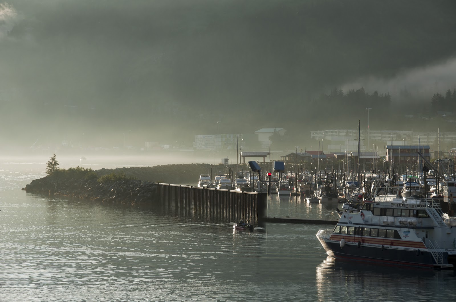
The disembarkation point of our cruise was Whittier which is 60 miles southeast of Anchorage.  As we stepped out of the cruise ship in early morning, stunningly beautiful Whittier harbor and nearby mountains veiled in fog greeted us.  Not far from the cruise terminal, there lies the 2.5 miles long Anton Anderson Memorial Tunnel in one lane shared by both cars and trains.  It is the second longest highway tunnel of North America (50 ft shorter than the Ted Williams+I-90 extension in Boston) and is the only land access of Whittier to the outside world through the Portage Glacier Highway. 


The short drive through the Portage Glacier Highway was breathtaking.  We in fact returned to the area a few days later for more photo shoots and hikes to see the lake and glaciers.  20 miles west, Portage Glacier road meets the Seward Highway which is a part of Alaska Route 1.  If you turn left and heads west-southwest, you can explore the heart of Kenai Peninsula.   Turning right and head north, you soon see Turnagain Arm to your left with Anchorage at the far north of the mouth of the Arm at more than 30 miles away.  Turnagain Arm is one of the about five dozen places in the world where one can see tidal bore. (but it is not nearly as impressive as the one at Qiantang River of China which has the world's largest bore - up to 30 ft high and moving at up to 25 miles per hour.)   During high tides, pods of Beluga whales or white whales (ok, it is a misnomer and is really more like dolphins) follow and chase the silver salmon all the way upstream from Cook Inlet.  It is not difficult to spot some of these cute mammals along the highway, one of the only two places in North America where you can watch Beluga whales in the wild.


Turnagain Arm northward
Alaska Fireweed

Turnagain Arm when low tide


Continuing north on Alaska Route 1 past Anchorage, a mere 30 miles out, one reaches Wasilla which is a small suburban town of Anchorage with less than 8,000 residents.   It is now internationally known, thanks to Sarah Palin who was its mayor from 1996 till 2002.  She was elected as the Governor of Alaska in 2006 and became the Republican Party nominee for Vice President in the 2008 election.  To boost her credential on international affairs, Sarah Palin had made the famous statement: "They're our next-door neighbors, and you can actually see Russia from land here in Alaska, from an island in Alaska." Although the statement was technically correct, it was such a stretch from her demonstrated intellects and experiences that the statement became a constant joke of her ignorance of foreign affairs. 

Picking up Alaska Route 3, aka the George Parks Highway after Wasilla and going north along the imposing Alaska Range at the west, one can enjoy a pleasant drive to Denali National Park 200 miles away.  The word "Denali" came from the native Athabaskan language.  It means "the high one", referring to the Mount Denali of the park.  It is also known as Mount McKinley, named after president William McKinley of Ohio in 1897.  Mount Denali is the highest mountain of North America.  Peaked at 20,327 ft, it is simply a gigantic piece of granite that was lifted up into the sky from Denali Fault as a result of tectonic activities over 10's of millions of years. 

Denali National Park and Reserve has more than 4 million acres in area and is the third largest national park of U.S.   Because of the low temperature and short growth seasons, Denali National Park has little wooded areas.  Instead, tundra at various elevations with beautiful fall colors covered much of the ground no matter at which directions you look.  There is only one Park Road of 91 miles long that takes one from the park entrance to the mining camp of Kantishna.  The first 15 miles is open to private vehicles.  The remaining 76 miles of narrow gravel road is only accessible by Park concessionary buses.  A round-trip bus ride with short stops along the way all the way to Kantishna would be a 12+ hours venture.   The reward though is the spectacular sceneries and possible encounters with wildlife – grizzly bears, mountain sheep, moose, and more.  One new thing I learned from watching a film at the visitor center was the most impressive camouflage I have ever seen.  Look at the photos below and compare the Willow Ptarmigans (the state bird of Alaska) in late Aug that we saw and a photo of a Ptarmigan in winter that I downloaded from Internet!   


More selected photos follow them below.  With a three-night stays, we barely scratch the surface.  Next time, we hope we have a better luck with the weather and have more time to hike at various parts of the park.

A lone grizzly bear
A lone visitor


Eielson Visitor Center
Wonder Lake


Mount McKingley seen from Alaska Route 1


Before I go, I should say a few words about food.  Material wise, you can’t go wrong with fresh local salmon and halibut.  But if you are not sure about the joint, simply order entrees that retain the original flavor as much as possible. We have had decent food at most of the places we visited including the café in the Denali Park.  We also had a wonderful outdoor lunch break and leisure walk at Talkeetna on the way to Denali from Anchorage.  It is a lovely small town with quite a few cozy restaurants.  I had Caribou Chili and a special Ale made with Fireweed honey.  With 9% alcohol, that Ale was the strongest beer I have ever had but is very good.  The Caribou Chili was nicely done too.  It didn't taste gamey as one might fear.   Perhaps it has something to do with the fact that restaurants in U.S., as required by law, can only serve game meats that are farm-raised? 

Talk to you soon!